g
geospatial_engr

Geospatial

@geospatial_engr
4,9(60)

Level 2

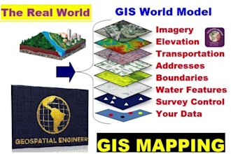
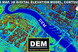
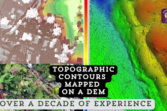
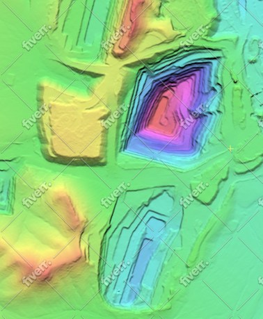
Pro Experts in GIS, Mapping, 3D Models, Drones, and Civil Engineering

Pakistan
Englisch
Einige Informationen werden in englischer Sprache angezeigt.
Über mich
I offer professional services in GIS, mapping, geospatial analysis, 3D modeling, land surveying, topographic contours, digital elevation models, drone photogrammetry, flood modeling, and civil engineering services, including site plans and design. From satellite image analysis to Google Earth flythroughs, interactive web map applications, and CAD drawings, we deliver customized solutions, for large-scale projects and individual property needs. I am committed to accuracy, fast delivery, and client satisfaction. Feel free to inbox before placing your order!... Mehr lesen

Kompetenzen

g
geospatial_engr
Geospatial
30 $/Stunde
offline • 
Durchschnittliche Antwortzeit: 1 Stunde

Meine Dienstleistungen

Geoinformationssysteme (GIS)
I will create accurate digital elevation models, dem, dsm, dtm, contours, and gis maps
4,9(16)
2D-Zeichnungen & Lagepläne
I will create contour map and topographic plan using survey or gis data
4,8(16)

Möchtest du auf Stundenbasis arbeiten?

Erzähle Geospatial, was du brauchst.

30 $

/

Stunde

Portfolio

60 Bewertungen
4,9

(56)
(4)
(0)
(0)
(0)
Zusammensetzung der Bewertung
  • Kommunikation
    4,9
  • Qualität der Lieferung
    4,8
  • Preis-Leistungs-Verhältnis der Lieferung
    4,8
1–5 von 60 Bewertungen
Sortieren nach:
Am relevantesten
    B

    bleblanc03

    US

    Vereinigte Staaten

    5

    Great to work with. Delivered nice assets for my project. I would not hesitate to reach out again if/when I need more work at this level.

    400 $-600 $

    Preis

    3 Wochen

    Dauer

    gig

    Geoinformationssysteme (GIS)

    Bild des Arbeitsbeispiels
    Hilfreich?
    Ja
    Nein
    L
    image-docs

    lynntaylor

    US

    Vereinigte Staaten

    4

    Thank you!!!!!!!!!!!!!!!!!!!!!

    50 $-100 $

    Preis

    5 Tagen

    Dauer

    gig

    2D-Zeichnungen & Lagepläne

    Hilfreich?
    Ja
    Nein
    J

    jebjeb2000

    US

    Vereinigte Staaten

    4,3

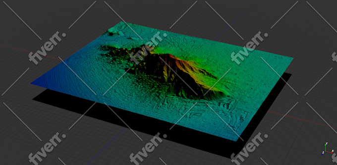
    I needed a model of a mountain for architectural rendering. Geospatial provided a highly detailed file that was actually far too large for my program to handle. Geospatial followed up with several options of smaller size, and I was able to use the edits. They were communicative in adjusting the parameters to fit what I needed. Thank you!

    100 $-200 $

    Preis

    2 Wochen

    Dauer

    gig

    Geoinformationssysteme (GIS)

    Bild des Arbeitsbeispiels
    Hilfreich?
    Ja
    Nein
    J

    jasonwarner845

    Wiederkehrender Kunde

    CR

    Costa Rica

    5

    Thank you once again.

    50 $-100 $

    Preis

    4 Tagen

    Dauer

    gig

    Geoinformationssysteme (GIS)

    Hilfreich?
    Ja
    Nein
    J

    jasonwarner845

    Wiederkehrender Kunde

    CR

    Costa Rica

    5

    Thank you once again.

    Bis zu 50 $

    Preis

    6 Tagen

    Dauer

    gig

    Geoinformationssysteme (GIS)

    Hilfreich?
    Ja
    Nein