Ich werde eine Kartierung der Bodenbedeckung und -nutzung durchführen

Z
zaddy84
Z
zaddy84
Zadock K
Einige Informationen wurden automatisch übersetzt.

Über diesen Service

Automatische Übersetzung

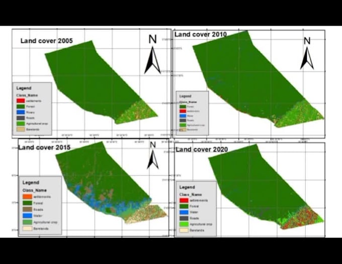
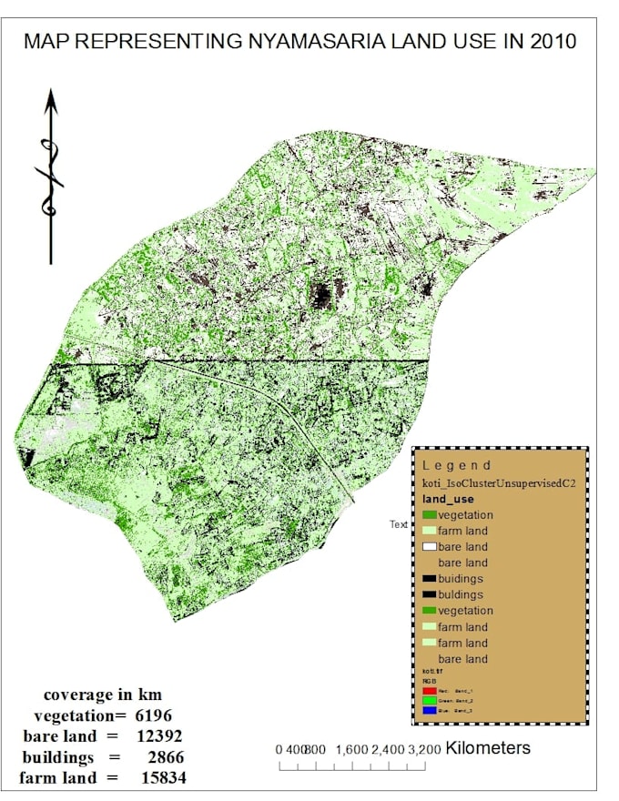
Ich werde QGIS, ArcGIS, Google Earth API für die Landnutzung- und Landbedeckungskartierung verwenden. Die Dienstleistungen beginnen mit Satellitenbildverarbeitung, grundlegender Landnutzungskartierung und Zeitreihenanalyse.

Lerne Zadock K kennen

Zadock K

I specialize in GIS, remote sensing and google earth engine

5,0(4)
  • AusKenia
  • Mitglied seitJuni 2024
  • ⌀ Antwortzeit3 Stunden
  • Letzte Lieferung4 Monate
  • Sprachen

    Englisch
Welcome to my GIS & RS , I excel in utilizing software tools such as ArcMap, QGIS, ArcGIS Pro, Python, and ArcGIS Online. Whether you're seeking expert services or looking to enhance your own skills, don't hesitate to reach out. The service I provide include 1 Digitization 2 Georeferencing 3 Hydrology analysis 4 Climate change analysis 5 Satellite image analysis 6 Vector raster analysis 7 Geospatial analysis 8 Developing web maps using Leaflet and OpenLayers. 9 spatial analysis in GIS, 10 creating GIS models, 11 web mapping 12 WebGIS, 13 ArcGIS online services

Automatische Übersetzung