Kategorien durchsuchen
Entdecken
Fiverr Pro
Deutsch
$
USD


Build a GIS Web Map for Geospatial Visualization
Welcome! I am a GIS Engineer with 3+ years of experience in spatial data analysis, web GIS development, and 3D visualization. I will help you turn your geographic data into an interactive, professional web map.
What I offer:
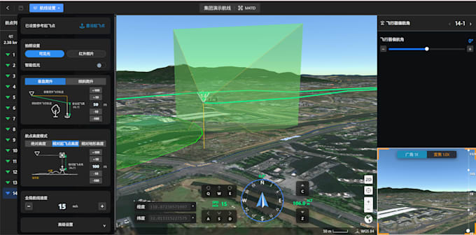
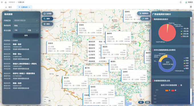
I specialize in building custom web maps using leading GIS technologies including Cesium.js, Leaflet, OpenLayers, ArcGIS, and GeoServer. Whether you need a simple interactive map or a complex 3D geospatial platform, I can deliver a solution tailored to your needs.
Services include: Interactive web maps with custom markers, layers, and pop-ups 3D terrain and route visualization (Cesium.js) Spatial data analysis and processing Integration of your data (CSV, Shapefile, GeoJSON, KML)
Why choose me: Master's degree in Remote Sensing with research experience at NUS and A*STAR Singapore Proficient in Python, R, and PostGIS for advanced spatial analysis Fast delivery and clear communication Fluent in English and Chinese.
Have a project in mind? Feel free to message me before ordering so I can understand your requirements and recommend the best solution. Let's bring your spatial data to life!
GIS Engineer
Sprachen