Kategorien durchsuchen
Entdecken
Fiverr Pro
Deutsch
$
USD

Level 2


Automatische Übersetzung
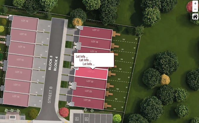
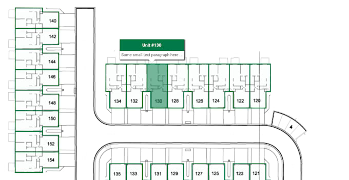
Ich werde deinen Grundriss in eine voll interaktive Karte für deine Webseite oder Anwendung verwandeln.
Technologien:
Was du bekommst:
I develop interactive maps for various needs
Level 2
Sprachen
Automatische Übersetzung
Automatische Übersetzung
Was brauchen Sie, um das Projekt zu starten?
Ich brauche deinen Grundriss (PDF, Bild oder CAD-Datei) und eine kurze Beschreibung, was interaktiv sein soll (klickbare Bereiche, Popups, Links usw.).
Welche Dateiformate akzeptieren Sie?
Ich kann mit PDF, JPG, PNG, SVG, DWG, DXF oder sogar handgezeichneten Skizzen arbeiten.
Was bekomme ich am Ende?
Du erhältst einen voll interaktiven Grundriss im HTML/SVG-Format, bereit zur Verwendung auf deiner Webseite
Kann ich das in meine Webseite einbetten?
Ja, die Karte kann einfach in jede Webseite mit HTML oder iframe eingebettet werden.