Kategorien durchsuchen
Entdecken
Fiverr Pro
Deutsch
$
USD
Water Resources, Climate Engineering Consultant
Level 1
Hat bestimmte Leistungskriterien erfüllt und zeigt großes Potenzial auf dem Marktplatz.
Need professional GIS, Remote Sensing, Python, or Google Earth Engine support? I provide geospatial analysis, mapping, automation, and environmental data solutions for engineering, water resources, climate change, and infrastructure projects.
Services include:
GIS Analysis using ArcGIS & QGIS
Catchment & Watershed Delineation
Floodplain Mapping & Risk Assessment
Satellite Image Processing & Classification
Land Use/Land Cover (LULC) Mapping
Google Earth Engine Applications
Python & R Automation for GIS Workflows
Climate & Environmental Data Analysis
Spatial Database Development (PostGIS)
Interactive Dashboards & Data Visualization
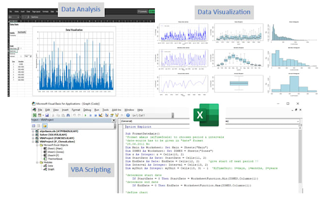
Excel VBA & Reporting Automation
Deliverables:
GIS Maps & Spatial Analysis
Python/R Scripts
GEE Applications
Technical Reports & Figures
Spatial Databases & Dashboards
Why choose me?
Professional Engineering Background
Accurate & Reproducible Analysis
Fast Communication
On-Time Delivery
Contact me before ordering to discuss your project requirements and receive a customized solution.
Technologie:
Excel
•
Python
•
RStudio
•
vba
•
Andere
What services do you offer in R, Python, and GIS?
I provide data analysis, automation, visualization, and geospatial modeling using R, Python, Excel, Google Earth Engine, and Esri tools (ArcGIS, QGIS). Whether you need scripting, machine learning, web scraping, or custom GIS solutions, I can help!
Can you work with Google Earth Engine for remote sensing?
Yes! I specialize in Google Earth Engine (GEE) JavaScript/Python API for satellite imagery processing, NDVI analysis, land cover classification, and time-series mapping. Share your project details, and I’ll provide the best approach.
Do you create custom web applications for GIS projects?
Absolutely! I develop interactive web maps and GIS applications using JavaScript (Leaflet, OpenLayers), Python (Flask/Django), and frameworks like GeoDjango. Need a dashboard or real-time geospatial tool? Let’s discuss!
How do you handle Excel automation and advanced data analysis?
I automate Excel tasks (VBA) and perform pivot tables, regression analysis, and dynamic reporting. If you’re tired of manual work, I’ll streamline your workflow with smart solutions.
What if I need revisions or additional changes?
I offer free revisions within the agreed scope. For major changes, we can discuss a fair adjustment. My goal is to ensure you’re 100% satisfied with the deliverables!
How do I share project files/data securely
You can send files via Fiverr’s secure messaging