u
udaysm

Uday Munda

@udaysm
4,7(1)

GIS and Remote Sensing Analyst

Indien
Einige Informationen werden in englischer Sprache angezeigt.
Über mich
I am a GIS & Remote Sensing Analyst specializing in geospatial analysis, satellite image processing, and professional map design. I provide LULC mapping, Land Surface Temperature (LST) analysis, urban heat mapping, watershed delineation, terrain analysis, georeferencing, digitization, and spatial analysis. I work with ArcGIS, QGIS, ERDAS IMAGINE, R, Python, and Excel to create accurate, clear, and visually appealing maps. I focus on quality, attention to detail, and client satisfaction. Let’s discuss your GIS project!... Mehr lesen

Kompetenzen

u
udaysm
Uday Munda
offline • 

Meine Dienstleistungen

Geoinformationssysteme (GIS)
I will do gis analysis, lulc, geoprocessing, image classification
4,7(1)
Datenformatierung
I will do data entry, data cleaning, excel, data excel work

Portfolio

1 Bewertungen
4,7

(1)
(0)
(0)
(0)
(0)
Zusammensetzung der Bewertung
  • Kommunikation
    4
  • Qualität der Lieferung
    5
  • Preis-Leistungs-Verhältnis der Lieferung
    5
1–1 von 1 Bewertungen
Sortieren nach:
Am relevantesten
    T
    image-docs

    tharun_ravi

    IN

    Indien

    4,7

    Really provided the exact work that was requested. Happy to collaborate once again in the future.
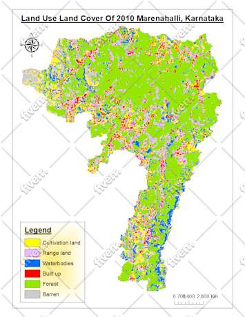
    50 $

    Preis

    2 Tagen

    Dauer

    gig

    Geoinformationssysteme (GIS)

    Bild des Arbeitsbeispiels
    Hilfreich?
    Ja
    Keine