Kategorien durchsuchen
Entdecken
Fiverr Pro
Deutsch
$
USD


Automatische Übersetzung
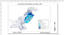
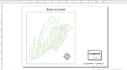
Ich erstelle professionelle GIS-Karten mit ArcGIS und QGIS. Ich kann thematische Karten, NDVI-Karten, LULC-Karten, Bodenkarten, Digitalisierung und grundlegende GIS-Analysen erstellen.
GIS and Remote Sensing Student
Sprachen
Automatische Übersetzung
Automatische Übersetzung
Welche GIS-Software verwendest du? Ich nutze ArcGIS und QGIS für GIS-Mapping und Analyse.
2. Welche Art von Karten kannst du erstellen? Ich kann thematische, NDVI-, LULC-, Boden- und andere GIS-basierte Karten erstellen.


