Ich führe alle geospatiale Analysen, Digitalisierung und verwandte Aktivitäten durch

S
shayo_elias
S
shayo_elias
Elias S
Einige Informationen wurden automatisch übersetzt.

Über diesen Service

Automatische Übersetzung

Ich werde:

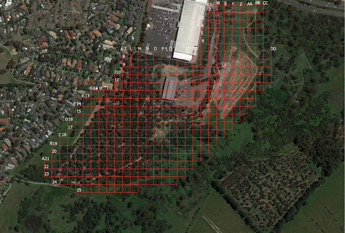
- Karten erstellen (thematische Karten, Hitze-Karten, Choroplethen)

- Geografische Muster analysieren (Entfernung, Dichte, Nähe)

- Räumliche Datenbanken verwalten (Shapefiles, GeoJSON, PostGIS)

- Karten mit Statistiken und realen Daten kombinieren

Lerne Elias S kennen

Elias S

Statistician

  • AusTansania
  • Mitglied seitFeb. 2026
  • ⌀ Antwortzeit2 Stunden
  • Sprachen

    Englisch
I am a competent and talented employee seeking experimental and applied learning opportunities and professional qualifications. I aim to give total support to the leaders I work for, utilizing my experience and capability. I am willing to learn from others to achieve organization goals and create mutual benefits.

Automatische Übersetzung