Einige Informationen werden in englischer Sprache angezeigt.
Über mich
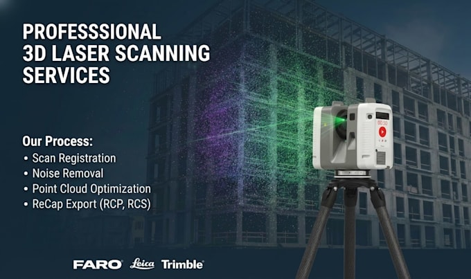
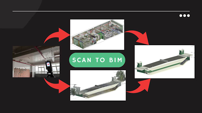
I'm a Geomatics Engineer with 10+ years in LiDAR, UAV photogrammetry, 3D scanning, and GIS. I’ve handled projects for buildings, factories, roads, bridges, and power plants. Using Leica, Faro, DJI drones, and software like Cyclone, Metashape, ArcGIS, and TBC, I turn point clouds into accurate 3D models and maps. Certified by Trimble, Leica, Faro. I ensure fast, high-quality delivery with client-focused service.... Mehr lesen