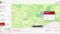
Ich werde gis-Karten, Raum- und Daten-Dashboards erstellen

P
peterboateng06
P
peterboateng06
PETER BOATENG
Einige Informationen wurden automatisch übersetzt.

Über diesen Service

Automatische Übersetzung

Sende mir deine Standortdaten, Felddaten oder Satellitenbilder, und ich verwandle sie in saubere GIS-Karten, Raum-Analysen oder Visualisierungen für Fernerkundung, die du für Berichte, Präsentationen, Forschung oder Planung nutzen kannst.

Lerne PETER BOATENG kennen

PETER BOATENG

GIS Mapping, Spatial Data and Dashboard Specialist

  • AusGhana
  • Mitglied seitAug. 2021
  • Sprachen

    Englisch
I help clients turn messy location and programme data into clear maps, dashboards and reports. I work with QGIS, ArcGIS Pro, Google Earth Engine, KoBoToolbox, Excel, MapLibre and Chart.js. My work covers GIS mapping, spatial analysis, remote sensing, data cleaning, field data forms, web maps and evidence packs. I have supported projects in public health, urban planning, transport safety, environmental risk and donor-funded programme delivery. Clear data, clean visuals and reliable communication are what I focus on.

Automatische Übersetzung

Mein Portfolio