Kategorien durchsuchen
Entdecken
Fiverr Pro
Deutsch
$
USD

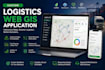
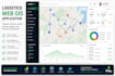
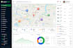
Develop a Custom Logistics Web GIS Application for Smarter Fleet & Delivery Management
Looking for a powerful Logistics Web GIS application to streamline your transportation, fleet operations, or supply chain? You're in the right place!
I develop custom, responsive, and scalable Web GIS applications that help logistics companies visualize, analyze, and manage spatial data through interactive maps. Whether you need delivery route planning, fleet tracking, warehouse mapping, or transportation analytics, I can build a solution tailored to your business requirements.
What I Can Build
Please contact me before placing an order so we can discuss your project requirements, features, timeline, and the best package for your needs.
Oscar Dev
Sprachen
What types of logistics Web GIS applications do you develop?
I develop custom Web GIS applications for fleet management, delivery route planning, warehouse mapping, service area analysis, transportation networks, asset tracking, and logistics dashboards. Each solution is tailored to your business requirements.
Can you integrate my existing data or APIs?
Yes. I can integrate GPS data, REST APIs, databases, GeoJSON, Shapefiles, KML/KMZ, CSV files, and other supported geospatial data sources into your application.
Can you build a responsive application that works on mobile devices?
Yes. All Web GIS applications are designed to work smoothly on desktops, tablets, and mobile devices.
Which technologies do you use?
I work with modern GIS and web development technologies, including Leaflet, OpenLayers, Mapbox, React.js, JavaScript, TypeScript, Python (FastAPI, Flask, Django), PostgreSQL/PostGIS, GeoServer, HTML, and CSS.
Which technologies do you use?
I work with modern GIS and web development technologies, including Leaflet, OpenLayers, Mapbox, React.js, JavaScript, TypeScript, Python (FastAPI, Flask, Django), PostgreSQL/PostGIS, GeoServer, HTML, and CSS.
Can you deploy the application to my server?
Yes. I can deploy the application to your hosting environment or cloud server and help with the initial configuration if required.
Do you provide source code?
Yes. The complete source code is included with the final delivery unless we agree otherwise before the project starts.
Can you add user authentication and different access levels?
Yes. I can implement secure login systems, role-based permissions, and user management based on your project requirements.
Do you offer custom features that are not listed in the gig?
Absolutely. Every logistics business has unique needs. Contact me with your requirements, and I'll provide a custom solution and a personalized offer.


