Ich werde die Dem-Verarbeitung, die Abgrenzung von Wassereinzugsgebieten und die Vernetzung von Bächen in GIS durchführen

N
noorzadi
N
noorzadi
Noor Z.
Einige Informationen wurden automatisch übersetzt.

Über diesen Service

Automatische Übersetzung

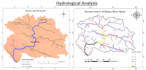
Ich bin GIS-Experte mit Erfahrung in Digital Elevation Modeling, GIS-Kartierung, Fernerkundung, Landvermessung und Geodatenanalyse.


Für dieses GIG biete ich folgende Dienstleistungen in meinen Geoinformationssystemen an


  1. Beschaffung von DEM-Daten (Höhenmodell als Raster oder Vektor) für ein beliebiges Gebiet.
  2. Einzugsgebietabgrenzung: Entwässerungsbecken und Einzugsgebiet/Basiskanten, Sub-Basin-Karte usw.
  3. Geländeklassifikation: Einteilung der Landschaft in verschiedene Höhenklassen.
  4. Hydrologisches Modellieren: Wasserflussmuster, Flussansammlungen, Flussrichtungen, Generierung von Entwässerungs- und Flussnetzwerken, Stream-Order-Netzwerke.
  5. Geodatenintegration

Grundlegende Software

  • ArcGIS
  • QGIS

Lerne Noor Z. kennen

Noor Z.

I will do all sort of Remote sensing and GIS Mapping using Arc GIS

5,0(1)
  • AusPakistan
  • Mitglied seitNov. 2020
  • ⌀ Antwortzeit2 Stunden
  • Letzte Lieferung1 Jahr
  • Sprachen

    Urdu, Englisch
Greetings! I'm Noor Zadi, a Geo-Informatics Engineering Professional specializing in Cartography & GIS. I offer precise Geo-Spatial Data Analysis, RS-GIS Mapping, Cartography Solutions and all kind of spatial data handling with a commitment to time, accuracy and high quality. I Have years of experience working with Arc GIS Applications and I was found very much organized, productive passionate, hardworking & well-mannered. I utilize my skills in the possible way to come up with good work, you will get to find the satisfied work in the given time. Thank you for your precious time to go through.

Automatische Übersetzung

Verwandte Tags