Willkommen bei meinem GigIch digitalisiere topografische Karten, Satellitenbilder oder andere Bilder/Karten in Arcgis
ich werde
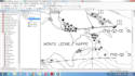
- Geo-Referenzierung
- Digitalisiere deine Rasterdaten, um sie in Vektordaten umzuwandeln
- Ich werde die Vektordatei in den folgenden Formaten bereitstellen: shapefiles, Geodatabase, Kml, Kmz, Eps, Ai usw.
- Erstelle eine klare, professionelle Karte
Ich werde Arbeit leisten, um dir 100%ige Zufriedenheit zu garantieren
Der Preis ist verhandelbar
Bevor du eine Bestellung aufgibst, schick mir eine Nachricht!
Danke
Beste Wünsche!!!
Nomi