Einige Informationen werden in englischer Sprache angezeigt.
Über mich
Hi!
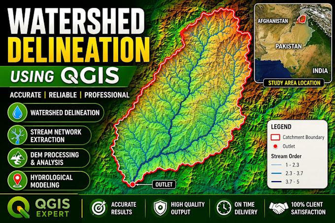
I am a GIS Analyst and QGIS specialist providing professional thematic maps, spatial analysis, and geospatial visualization services. I work with Catchment Delineation,/Watershed Analysis administrative boundaries, DEMs, contours, terrain analysis, and OpenStreetMap data to deliver accurate and visually clear maps.
I ensure proper CRS, clean data processing, and well-designed map layouts suitable for reports, research, and planning. Client satisfaction, clear communication, and on-time delivery are my priorities.
Feel free to contact me! discussion is always free.... Mehr lesen