Kategorien durchsuchen
Entdecken
Fiverr Pro
Deutsch
$
USD

Level 1
Bringing Data to Life with GIS, Remote Sensing, 2D, 3D Map Animations
Kompetenzen
Meine Dienstleistungen
Möchtest du auf Stundenbasis arbeiten?
Erzähle Nasir Farid, was du brauchst.
20 $
/
StundeGIS/RS Analyst
Fiverr • Freiberufler
Jun 2018 - Present • 8 yrs 1 mo
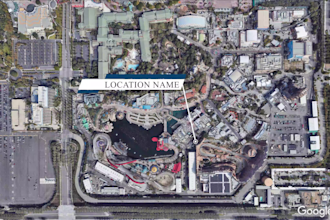
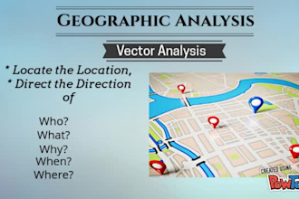
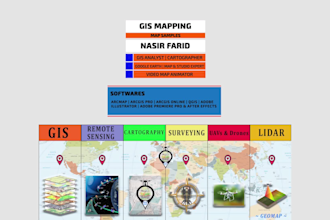
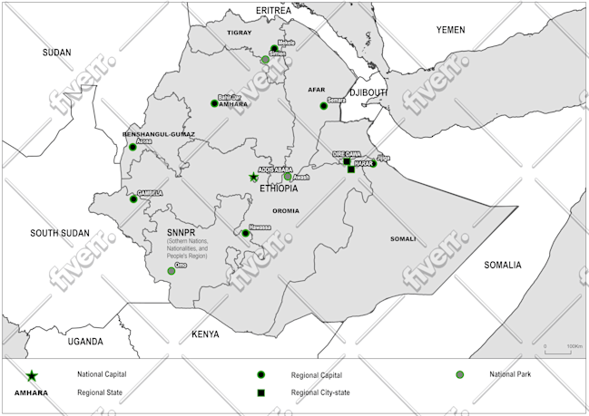
Transforming Data into Insightful Solutions with GIS, Remote Sensing & 2D/3D Animation GIS and Remote Sensing professional with over 08 years of experience in geospatial analysis, mapping, and video animation. With a bachelor's and master's degree in Geomatics (GIS & RS), I specialize in delivering reliable, accurate, and visually compelling solutions tailored to your project needs. What I Bring to the Table: - Advance GIS & RS expertise to simplify complex geospatial challenges. - Proven ability to enhance data reliability and maximize project productivity. Software Proficiency: GIS & Remote Sensing Tools: ArcMap, ArcGIS Pro, QGIS, ERDAS Imagine, ENVI Design & Animation: Adobe Illustrator, Adobe Photoshop, Adobe Premiere Pro, Adobe After Effects, Google Earth Pro, Google Earth Studio and Microsoft Office Suite Core GIS & Remote Sensing Expertise: - Georeferencing, digitization, and geodatabase management - Remote Sensing data analysis for environmental and land use application - Spatial analysis, modeling, and visualization - Cartography/Digital Mapping - Data cleaning, processing, and file conversion (KML/KMZ, GeoJSON, Shapefiles) Let's collaborate to transform your data into actionable insights or create engaging video animation. I look forward to working on your project!
| (73) | ||
| (2) | ||
| (0) | ||
| (1) | ||
| (2) |
alamopro
Wiederkehrender Kunde

Vereinigte Staaten
Nasir Did a great job handling the tedious task of measuring various small lines needed for my map project. He was proactive in his communication and helped me to discover solutions to challenges that I had not considered. I will definitely work with him should the need arise. I highly recommend him!
Antwort des Freelancers
alamopro
Wiederkehrender Kunde
Vereinigte Staaten
Great work! Willing to work with me on the details needed to accomplish the goal. I highly recommend him!
Antwort des Freelancers
bsw_2009
Wiederkehrender Kunde
Vereinigte Staaten

Antwort des Freelancers
bsw_2009
Wiederkehrender Kunde
Vereinigte Staaten
Antwort des Freelancers
daniel_glenn_cl
Vereinigte Staaten
Amazing Google Earth video for one of my real estate clients. Appreciate the the quick turnaround and professionalism!


Antwort des Freelancers