Kategorien durchsuchen
Entdecken
Fiverr Pro
Deutsch
$
USD

Geospatial Engineer, Remote Sensing and GeoAI, QGIS Plugin Developer, ArcGIS Pro
Kompetenzen
Meine Dienstleistungen

R2V
Vollzeit • 3 yrs 5 mos
GIS Expert / Team Lead
Apr 2024 - Present • 2 yrs 7 mos
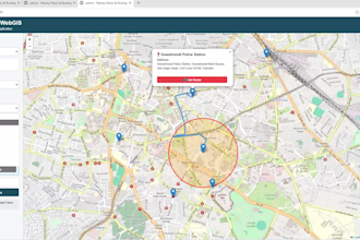
Led WebGIS platform and dashboard development using QGIS, Leaflet, OpenLayers, GeoServer, and PostgreSQL/PostGIS. Managed 20+ GIS layers across land planning, horticulture, revenue, and operational modules. Automated spatial workflows with Python, integrated REST APIs, and maintained data quality through topology validation, attribute checks, and coordinate system verification. Coordinated GIS and survey updates and mentored two junior GIS staff.
GIS Analyst
Jun 2023 - Apr 2024 • 10 mos
Performed commercial land-use analysis, urban growth assessment, and corridor suitability mapping for planning projects. Produced 12+ thematic maps and five analytical reports supporting zoning and infrastructure decisions. Used QGIS and PostGIS for data cleaning, spatial analysis, and geoprocessing. Developed reusable processing models and coordinated with survey teams to validate satellite-derived land-use classifications against field observations.

GIS Assistant
AOS Tech • Teilzeit
Feb 2022 - Jul 2022 • 5 mos
Supported agricultural planning through satellite imagery analysis, GIS mapping, and land resource assessment. Produced land use and land cover classifications covering agricultural areas, settlements, water bodies, and vegetation. Analyzed land-use changes, validated classification outputs against field survey points, and prepared district-level statistics to support agricultural monitoring and resource planning.
