Ich entwerfe Karten, ArcGIS-Karten und GIS-Projekte

M
mutemit
M
mutemit
Titus Mutemi
Einige Informationen wurden automatisch übersetzt.

Über diesen Service

Automatische Übersetzung

Hallo...

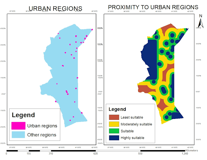
Ich erstelle topografische Karten, Analyse-Karten, Raum- und Flächennutzungsanalysen sowie alle ArcGIS-Projekte.

Ich erstelle DEMs aus Google Earth, Konturen und Standortkarten.

Ich nutze Satellitenbilder für Klassifikationen mit Erdas Imagine und ArcGIS.

Lerne Titus Mutemi kennen

Titus Mutemi

Geomatics Engineer,GIS Analyst

  • AusKenia
  • Mitglied seitDez. 2022
  • Sprachen

    Englisch
Hello there..I am a trained Surveyor and GIS(Geographic Information Systems) Analyst. I hold a bachelors degree in Geomatics Engineering and GIS & Remote Sensing. I have a 6 years experience in this field and expert in using various GIS software including QGIS, ArcGIS, Global Mapper, Google Earth and related. Survey software; AutoCAD, Civil 3D. Remote Sensing software; Envi and Erdas Imagine.

Automatische Übersetzung