Kategorien durchsuchen
Entdecken
Fiverr Pro
Deutsch
$
USD
Ich helfe Bauern, Agrarbetrieben und Forschern dabei, den Gesundheitszustand ihrer Kulturen mit kostenlosen Satellitendaten zu überwachen – ganz ohne Feldsensoren.
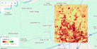
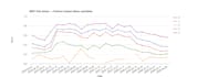
Mit Google Earth Engine und Sentinel-2, MODIS sowie ERA5-Land erstelle ich Vegetationsgesundheitsanalysen anhand von Indizes wie NDVI, FAPAR, FVC und ARI. Dabei verwandle ich Rohsatellitenbilder in entscheidungsreife Erkenntnisse für die Erkennung von Stress, Bewässerungslücken, Ertragsrisiken und farmbezogene Beratungsoutputs.
Ich habe End-to-End-Systeme für ein Unternehmen im Bereich Präzisionslandwirtschaft entwickelt: von der Erkennung der Farm-Grenzen (SAR + optische Fusion, auf SAM basierende Segmentierung) bis hin zu Diagnose-Dashboards für die Pflanzenentwicklung, die KI-basierte Farm-Advise-Platformen speisen, die in echten Projekten eingesetzt werden.
Was ich liefern kann:

Automatische Übersetzung
F: Welche Eingaben benötigst du von mir?
A: Ich brauche dein Interessensgebiet (AOI), den gewünschten Zeitraum und welche Art von Analyse du möchtest (LULC, LST, Veränderungsdetektion oder alles).


