Kategorien durchsuchen
Entdecken
Fiverr Pro
Deutsch
$
USD


Automatische Übersetzung
Hi, ich bin Mireille, eine GIS-Analystin, die sich auf QGIS und räumliche Datenanalyse spezialisiert hat. Ich erstelle thematische Karten und geospatiale Analysen, die bei Stadtplanung, Umweltmanagement, Territorialplanung und Naturschutzprojekten unterstützen. Dabei nutze ich QGIS und Umweltdaten. Ich helfe Organisationen, Forschern, Beratern und Unternehmen, fundierte Entscheidungen durch präzise geospatiale Analysen und professionelle Kartografie-Produkte zu treffen.
Ich biete an:
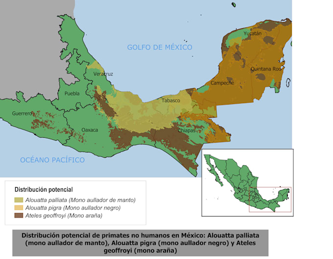
Professionelles Kartendesign mit Titel, Legende, Maßstab und Nordpfeil
Individuell angepasste Symbologie und Beschriftung
Integration von Vektordaten (Punkte, Linien und Polygone)
Integration von Rasterdaten
Export in hoher Auflösung im JPG- und PDF-Format
GeoPackage (.gpkg) Dateien und GIS-Schichten (je nach gewähltem Paket)
GIS Analyst QGIS, Spatial Analysis
Sprachen
Automatische Übersetzung