Einige Informationen wurden automatisch übersetzt.
Vollbild
Vollbild
Über diesen Service
Automatische Übersetzung
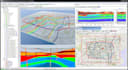
Ich liefere umfangreiche räumliche Analysen basierend auf den neuesten Daten und/oder
alle anderen bereitgestellten Datensätze. Das Ergebnis wird in Form von GIS-Shapefiles oder Excel-Daten (Geocode)-Dateien sein. Ich kann mit vielen Arten von Datensätzen arbeiten. Wenn du Fragen hast, frag einfach.
Anwendung
ArcGIS
Lerne Manju Lata kennen
Manju Lata
GIS Engineer
4,7(4)
AusIndien
Mitglied seitApr. 2017
Letzte Lieferung6 Jahre
Sprachen
Englisch
As a seasoned Architecture and GIS expert, I bring over 6 years of experience in the field. With a strong foundation in Remote Sensing and GIS, I've developed expertise in plan work, mapping, and spatial analysis. Mapping has been a passion of mine since high school, and I've honed my skills through extensive experience and education. My expertise spans.
- Architecture and building design
- Geographic Information Systems (GIS)
- Remote Sensing
- Plan work and mapping
- Spatial analysis and visualization
I'm excited to leverage my skills and experience to drive innovative solutions and project