Kategorien durchsuchen
Entdecken
Fiverr Pro
Deutsch
$
USD

Level 1

Automatische Übersetzung
Bitte kontaktieren Sie mich vor Ihrer Bestellung, um Projektanforderungen und individuelle Angebote zu besprechen!
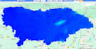
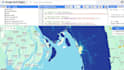
Benötigen Sie professionelle Geodatenanalysen mit Google Earth Engine (GEE)?
Ich kann Ihnen bei der Verarbeitung, Analyse und Visualisierung großflächiger Satellitenbilder mithilfe cloudbasierter Geodaten-Workflows helfen.
Angebotene Dienstleistungen
-️ Kartierung der Landnutzung und Landbedeckung (LULC)
- Verschiedene Indizes (NDVI, EVI, SAVI, LST und Vegetationsanalyse)
- Analyse der Stadterweiterung
- Änderungsanalyse
- Hochwasserkartierung
- Wasserkörperentnahme
- Dürreüberwachung
- Luftqualitäts- und Umweltanalyse
- Zeitreihenanalyse
- Sentinel-1 SAR-Analyse
- Optische Bildverarbeitung von Sentinel-2
- Landsat-Bildanalyse
- Benutzerdefinierte Google Earth Engine-Skripte
- GIS-Datenvisualisierung und Kartierung
- Unterstützung von Forschungs- und akademischen Projekten
- Bildnachbearbeitung im Premium-Service enthalten
Liefergegenstände-
- Hochwertige Karten und Datensätze
- GEE-Skripte
- Statistische Ergebnisse
- Diagramme und Visualisierungen
- PDF-Berichte (optional)
- GeoTIFF-, Shapefile-, GeoJSON- und CSV-Ausgabe
Warum mit mir zusammenarbeiten?
- Akademischer Hintergrund in GIS und Fernerkundung
- Forschungsorientierte Analyse
- Reproduzierbare Arbeitsabläufe
- Maßgeschneiderte Lösungen für jedes Projekt.
Level 1
Sprachen
Automatische Übersetzung


