j
jenishjana

Jenish

@jenishjana

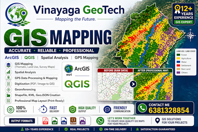
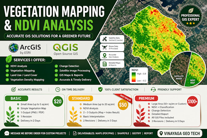
GIS Expert QGIS ArcGIS Mapping Spatial Analysis 12 Years Experience Professional

Indien
Tamil, Malayalam
Einige Informationen werden in englischer Sprache angezeigt.
Über mich
Hi, I’m Jenish, a GIS Expert with 12+ years of experience in geospatial mapping and spatial data analysis. I have worked extensively with the Tamil Nadu Forest Department and reputed organizations like World Wide Fund for Nature (WWF), delivering accurate GIS solutions. I specialize in GIS mapping, QGIS, ArcGIS, shapefile creation, geo-referencing, and satellite image analysis. I provide high-quality work, on-time delivery, and clear communication. Feel free to contact me anytime!... Mehr lesen

Kompetenzen

j
jenishjana
Jenish
offline • 
Durchschnittliche Antwortzeit: 1 Stunde

Meine Dienstleistungen

Grafik & Design
I will georeference and digitize your scanned map in qgis
Geoinformationssysteme (GIS)
I will create vegetation mapping ndvi analysis using arcgis qgis

Arbeitserfahrung

GIS Specialist

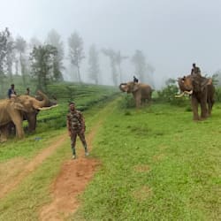
TN forest • Vollzeit

Feb 2012 - Present14 yrs 3 mos

GIS Specialist with 12+ years experience in mapping, georeferencing, and spatial analysis. Worked with Forest Department & WWF. Expert in ArcGIS, QGIS, and high-accuracy GIS solutions.