Kategorien durchsuchen
Entdecken
Fiverr Pro
Deutsch
$
USD

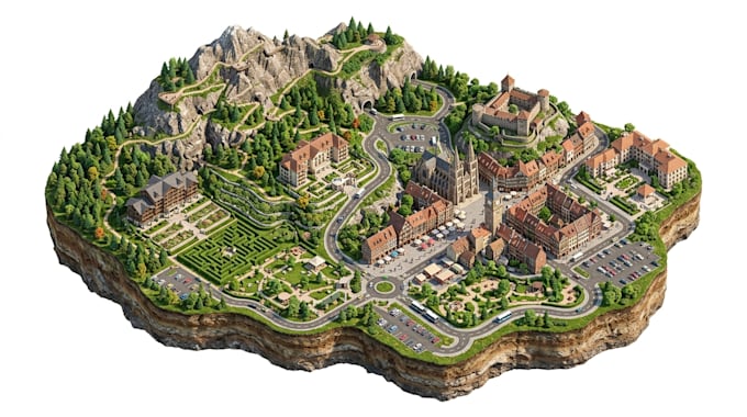
Need a professional map to help tourists and visitors explore a destination?
I design tourism maps, tourist maps, destination maps, visitor guide maps, city guide maps, sightseeing maps, travel maps, attraction maps, and illustrated location maps that make destinations easier to understand and explore.
I can create maps for:
Tourism boards and destinations
Cities and downtown areas
Hotels and resorts
Tourist attractions
Theme parks and entertainment destinations
Museums and cultural sites
Beaches and vacation destinations
Walking tours and sightseeing routes
Travel agencies and tour operators
Airbnb and vacation rentals
Historic districts and landmarks
Festivals and visitor events
Your map can include attractions, landmarks, roads, walking routes, hotels, restaurants, beaches, parks, transportation points, nearby destinations, parking areas, and other important visitor locations.
I can create 2D illustrated, vector, 3D isometric, realistic, or modern tourism map styles depending on your project.
You can provide Google Maps, satellite imagery, sketches, existing maps, photos, PDFs, location links, or reference designs.
Contact Me now Before you place order
Bitte informiere den Freelancer über alle Präferenzen oder Bedenken in Bezug auf den Einsatz von KI-Tools bei der Ausführung und/oder Lieferung deines Auftrags.
Map Designer Interactive, Isometric Wayfinding Maps
Sprachen
Can you create a tourism map for a city?
Yes. I can create city tourism maps showing attractions, landmarks, routes, hotels, restaurants and other visitor locations.
Can you create resort and hotel tourism maps?
Yes. I can combine the property with nearby attractions, beaches, restaurants, entertainment and important destinations.
Can you create a sightseeing or walking tour map?
Yes. Walking routes, sightseeing stops, attractions and points of interest can be clearly presented.
Can you create an isometric tourism map?
Yes. I can create detailed 3D isometric tourism and destination maps for a more visual visitor experience.
Can the map be used digitally and for printing?
Yes. I can prepare high-resolution files suitable for websites, social media, brochures, visitor guides and other digital or print applications.