Ich werde räumliche Analyse, gis-Kartierung, arcgis durchführen
H
H
Umar Hadi
Einige Informationen wurden automatisch übersetzt.
Vollbild
Vollbild
Vollbild
Über diesen Service
Automatische Übersetzung
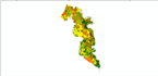
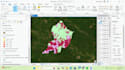
Angebotene Projekte, einschließlich:
Gebäudedigitalisierung
Palmendigitalisierung
Georeferenzierung
Landnutzungsanalyse
Layout
Landoberflächentemperatur
Puffer
Katastrophenrisiko
Landkapazität
Anwendung
ArcGIS
Lerne Umar Hadi kennen
Umar Hadi
GIS SPECIALIST AND URBAN PLANNER
AusIndonesien
Mitglied seitSept. 2021
Sprachen
Indonesisch, Englisch
I have studied skills and knowledge relevant to Geographic Information Systems (GIS) and planning in college until graduating. The Regional and City Planning Study Program is no stranger to the world of mapping because it is related to the output of planning results. As a planner, I have learned how to prepare master plans, spatial pattern directions, land capacity units, spatial structures, field surveys, and so on.