Einige Informationen werden in englischer Sprache angezeigt.
Über mich
I transform geospatial data into high-impact visual outputs. My workflow bridges the gap between raw GIS analysis (QGIS, ArcGIS) and cinematic 3D modeling (Blender) to produce professional terrain models and spatial analyses.
I offer:
• DEM/DSM 3D visualization
• Topographic mapping & contour extraction
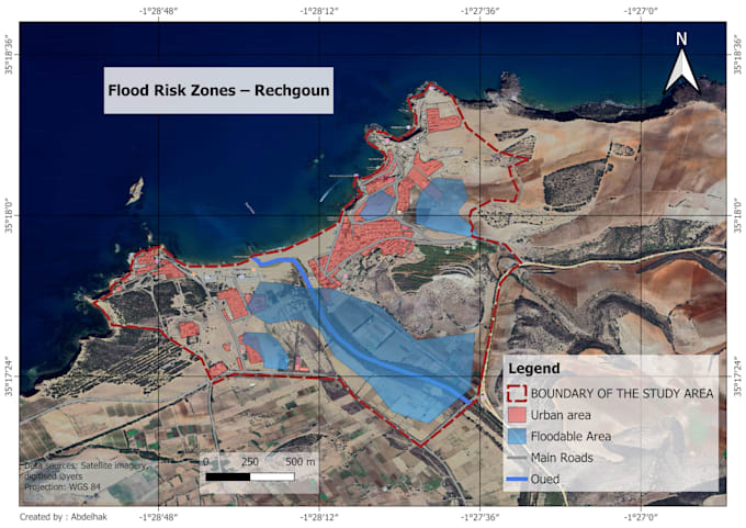
• Spatial analysis (Land use, flood, heat mapping)
• Custom map design for reports & presentations
My focus is on accuracy, clarity, and structural impact. If you need precise, usable, and professional visuals, I deliver results that stand out.... Mehr lesen