Kategorien durchsuchen
Entdecken
Fiverr Pro
Deutsch
$
USD

Automatische Übersetzung
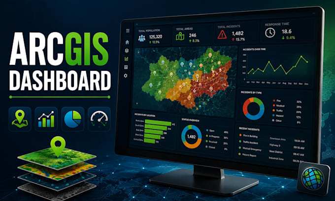
Suchst du nach einem professionellen ArcGIS Dashboard, um deine GIS- und Raumdaten in klare, interaktive Einblicke zu verwandeln? Ich erstelle maßgeschneiderte interaktive GIS-Dashboards, die Karten, Diagramme, Indikatoren und Raumdatenvisualisierung zu benutzerfreundlichen Entscheidungsunterstützungslösungen kombinieren.
Ich spezialisiere mich auf ArcGIS Dashboards, ArcGIS Online, GIS-Dashboards, Raumdatenvisualisierung, interaktive Dashboards, Web GIS, geospatiale Visualisierung und interaktive Kartierung.
Meine Leistungen umfassen:
Egal, ob dein Projekt Forschung, Umweltüberwachung, Stadtplanung, Transport, Business Intelligence oder andere geospatiale Anwendungen betrifft, ich kann eine Lösung entwickeln, die auf deine Projektanforderungen zugeschnitten ist.
Du erhältst ein sauberes, organisiertes und professionelles Dashboard, das komplexe Raumdaten leichter verständlich und erforschbar macht.
Bitte schreibe mir vor der Bestellung, wenn dein Projekt mehrere Datensätze oder fortgeschrittene Analysen umfasst
GIS Mapping and Geospatial Analysis Expert ArcGIS Pro QGIS and Web GIS
Sprachen
Automatische Übersetzung
Automatische Übersetzung
1. Was benötigst du, um mein ArcGIS-Dashboard zu erstellen?
Bitte gib deine Projektanforderungen, verfügbare Raumdaten, bevorzugte Metriken, Karten und Beispiele des Dashboards an, das du benötigst.
2. Kannst du mit meinen bestehenden GIS- und ArcGIS Online-Daten arbeiten?
Ja. Ich kann mit deinen verfügbaren GIS-Datensätzen, Webkarten und ArcGIS Online-Inhalten arbeiten, um ein passendes Dashboard zu erstellen.
3. Kannst du interaktive Karten, Diagramme und Filter hinzufügen?
Ja. Je nach Projektanforderungen kann ich interaktive Karten, Diagramme, Indikatoren, Widgets und Filtertools integrieren.
4. Für welche Projekte eignet sich ein ArcGIS-Dashboard?
Dashboards können Umweltüberwachung, Stadtplanung, Transport, Forschung, Business Intelligence und andere Raumdatenprojekte unterstützen.
5. Kannst du ein großes oder komplexes Dashboard-Projekt übernehmen?
Ja. Für Projekte mit mehreren Datensätzen, fortgeschrittener Raumdatenanalyse oder umfangreichen Dashboard-Anforderungen kontaktiere mich bitte zuerst für ein individuelles Angebot.
