Kategorien durchsuchen
Entdecken
Fiverr Pro
Deutsch
$
USD


Automatische Übersetzung
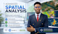
Ich biete fortgeschrittene räumliche Analysen und Satellitenbildinterpretationen mit ArcGIS Pro an, um umsetzbare geospatiale Erkenntnisse für deine Projekte zu liefern. Von Landnutzung und Umweltbewertung bis hin zu Infrastruktur- und Stadtplanung verwandle ich Rohdaten in klare, entscheidungsfertige Ergebnisse, die eine präzise Planung und bessere Entscheidungen unterstützen.
I help organizations make better decisions using location intelligence and GIS
Sprachen
Automatische Übersetzung
Automatische Übersetzung
Mit welcher Software & Daten arbeitest du?
Ich nutze ArcGIS Pro für Analyse und Visualisierung. Außerdem arbeite ich mit Satelliten- und Drohnenbildern sowie mit räumlichen und geografischen Datensätzen, einschließlich Punkten, Linien, Polygonen, Adressen und sozioökonomischen Daten wie Bevölkerung, Haushaltseinkommen, Gesundheitsdaten und mehr.
Muss ich Daten für mein Projekt bereitstellen?
Ja, von den Kunden wird erwartet, dass sie die benötigten Datensätze für die Analyse bereitstellen. Falls du keinen Zugriff auf die erforderlichen Daten hast, kann ich dir helfen, zuverlässige geospatiale Datensätze gegen Aufpreis zu beschaffen, abhängig von den Projektanforderungen und der Datenverfügbarkeit.
Was erhalte ich am Ende des Projekts?
Du erhältst klare, entscheidungsfertige Ergebnisse wie Karten, Dashboards, Berichte und Präsentationen, die auf deine Projektziele zugeschnitten sind, sowie alle unterstützenden Dateien oder Visualisierungen, die erforderlich sind.
