Einige Informationen werden in englischer Sprache angezeigt.
Über mich
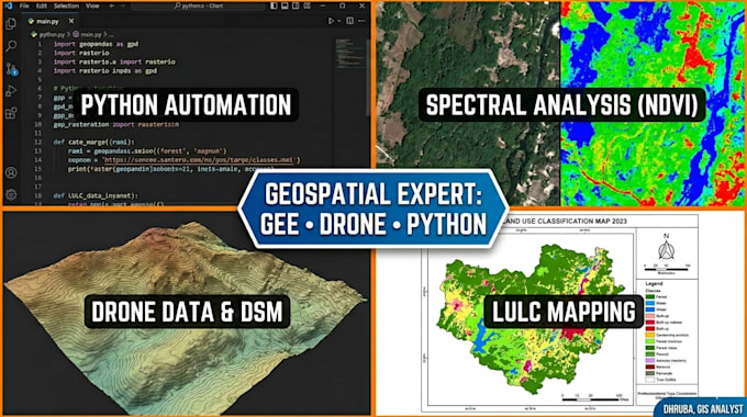
I'm a Geoinformatics M.Tech specializing in GIS analysis, remote sensing, and spatial data automation.
I've worked on real projects — solar site mapping with drone data, LULC classification using Sentinel-2 and Landsat, NDVI vegetation analysis, and carbon project screening for forest areas.
My toolkit: QGIS · ArcGIS · Python (geopandas, rasterio, scikit-learn) · Google Earth Engine · Sentinel-2 · Landsat
I deliver clean shapefiles, analysis reports, GeoTIFFs, and Python scripts — on time, with clear communication.
Available for quick turnaround tasks. Message me before ordering.... Mehr lesen