Ich werde CAD in GIS umwandeln

C
cartographer09
C
cartographer09
Abubakar Buledi
Einige Informationen wurden automatisch übersetzt.

Über diesen Service

Automatische Übersetzung

Willkommen bei meinem Service!

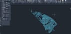
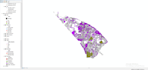
Ich werde deine CAD (DWG/DXF)-Dateien professionell in GIS-Formate umwandeln, entweder mit ArcGIS oder QGIS. Dabei sorge ich für saubere, präzise und gut organisierte GIS-Daten für dein Projekt.

Leistungen:

  • CAD in GIS umwandlung
  • DWG/DXF in Shapefile (SHP)
  • Geodatabase (GDB)
  • KML, KMZ, GeoJSON
  • Layer- und Attributorganisation
  • Koordinatensystemeinrichtung

Warum mich wählen?

  • Präzise Arbeit
  • Schnelle Lieferung
  • Gute Kommunikation
  • 100% Kundenzufriedenheit

Bitte schreibe mir vor deiner Bestellung, damit wir dein Projekt besprechen können. Ich freue mich auf die Zusammenarbeit!

Lerne Abubakar Buledi kennen

Abubakar Buledi

Abubakar buledi

5,0(1)
  • AusPakistan
  • Mitglied seitMärz 2022
  • ⌀ Antwortzeit1 Stunde
  • Letzte Lieferung2 Jahre
  • Sprachen

    Urdu, Sindhi, Englisch
Hello, I'm Abubakar Buledi, from Pakistan. I have done my 16th-year bachelor's in Geography and diploma in GIS and AutoCAD. I am an expert in maps creation. I can create all kinds of maps. I have worked on 2d and 3d maps by using ArcGIS and AutoCAD software. I can digitize your old maps into new maps. I can create flood maps with flood area calculations. Land cover and land use. And much more.

Automatische Übersetzung

Verwandte Tags