Einige Informationen werden in englischer Sprache angezeigt.
Über mich
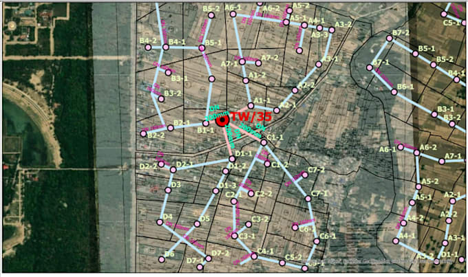
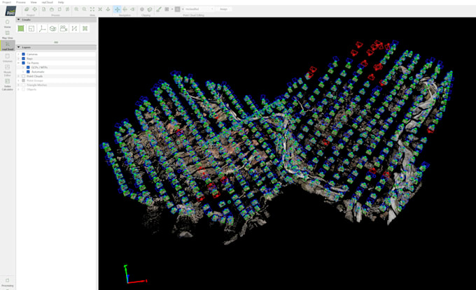
I am a geospatial professional specializing in GIS, remote sensing, UAV, and LiDAR data processing, delivering accurate, analysis-ready outputs for mapping and decision-making. My expertise includes vector digitization, topographic map creation, georeferencing, satellite image preprocessing and classification (LULC, indices), UAV photogrammetry, point-cloud processing, and LiDAR classification for terrain and feature extraction. I work with industry-standard tools to ensure clean topology, consistent coordinate systems, and reliable results, with a strong focus on data quality, timely delivery... Mehr lesen