Kategorien durchsuchen
Entdecken
Fiverr Pro
Deutsch
$
USD


Automatische Übersetzung
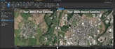
Suchst du nach präziser Landnutzung- / Landbedeckungsklassifikation, Stadtwachstumsüberwachung oder Umweltveränderungsdetektion?
Ich liefere gründliche Fernerkundungsanalysen und multi-temporale Satellitenklassifikationen für Forschung, Stadtplanung und Umweltberatung.
INKLUSIVE DIENSTLEISTUNGEN:
Überwachte Satellitenklassifikation (Random Forest, SVM, Maximum Likelihood)
Multi-temporale Veränderungsdetektion & Übergangsmatrix-Extraktion
Abholzung, Stadtwachstum, Oberflächenwasser & landwirtschaftliches Wachstum überwachen
Genauigkeitsbewertung (Gesamtgenauigkeit %, Kappa-Koeffizient, Confusion Matrix)
Exportfertige klassifizierte GeoTIFF-Raster & Vektor-Shapefiles
BEARBEITETE DATENQUELLEN:
Sentinel-2 (10m), Landsat 5/8/9 (30m), MODIS und PlanetScope.
Bitte kontaktiere mich vor der Bestellung, um deine Region des Interesses und das Klassifikationsschema zu bestätigen!
Remote Sensing Specialist, GEE Developer, and Agronomist
Sprachen
Automatische Übersetzung
Automatische Übersetzung
Welche Eingabedateien benötigst du von mir?
Ich benötige nur deine Boundary-Datei (.shp, .kml oder Koordinaten des Begrenzungsrahmens) und Zieljahre. Ich lade die Satellitenbilder automatisch herunter und verarbeite sie.


