Kategorien durchsuchen
Deutsch
$
USD
Deine KI mit Fiverr verbinden
Geospatial Analyst and Data annotator
Your AI model is only as good as the ground truth you train it on, and spatial data punishes sloppy labels.
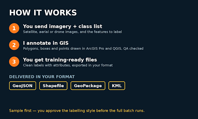
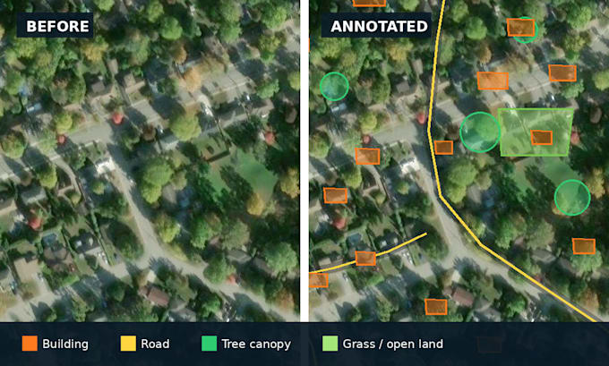
I am a geospatial analyst (MSc, Geography and Environment) and data annotator. I annotate satellite, aerial and drone imagery by hand in ArcGIS Pro and QGIS, drawing precise polygons and bounding boxes around real world features: buildings and rooftops, roads, land cover, water bodies, fields, trees and vehicles.
You get:
- Accurate polygons, boxes and points, drawn and checked inside GIS
- Your classes and attributes, exactly as your guideline defines them
- Delivery in GeoJSON, shapefile, GeoPackage or KML, ready for your pipeline
- A QA pass on every batch, with topology and overlap errors fixed before delivery
Send me a sample image and your class list first. I will annotate the sample, you approve the style, then I complete the full batch to that same standard.
This gig is only for spatial and imagery annotation. For general image, video, audio or text annotation, please see my other gig.
Technik:
Anleitung
Tagging-Typ:
Bild
How is this different from your other annotation gig?
That gig covers general annotation: images, videos, audio, text and sentiment tagging. This gig is only for geographic data: satellite, aerial and drone imagery and map features, annotated in GIS software and delivered in GIS formats.
What features can you annotate?
Buildings and rooftops, roads and paths, land cover and land use, water bodies, agricultural fields, trees and vegetation, vehicles, solar panels and similar visible features. If your feature is visible in the imagery, I can draw it.
What formats do I receive?
GeoJSON, shapefile, GeoPackage or KML as standard. If you work on an annotation platform, message me first and we will agree the export format before you order.
Can you follow my annotation guideline?
Yes, and I prefer it. Send your guideline and class definitions with your sample. If you do not have one, the Premium package includes setting up a clear label schema for you.
I have hundreds of images. Can you handle that?
Yes, in batches. Order a sample batch first so we lock the style, then message me for a custom offer for the full volume, priced per batch.