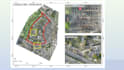
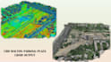
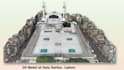
Ich erstelle GIS-Karte, geospatiale Analyse, Bildanalyse und individuelle GIS-Karten

A
amirgee
A
amirgee
Amir Abdullah
Einige Informationen wurden automatisch übersetzt.

Über diesen Service

Automatische Übersetzung

Ich bin GIS-Spezialist mit über 5 Jahren Erfahrung in Raum- und Fernerkundungsanalyse sowie professionellem GIS-Mapping.

Ich liefere Lösungen mit QGIS, ArcGIS Pro, Google Earth Engine, Global Mapper, Autocad, Agisoft Metashape Professional. Mein Fachwissen umfasst Raum- und Geostatistik sowie hochwertige kartografische Visualisierungen für Forschung oder jedes GIS-bezogene Projekt.

Meine Dienstleistungen

  • Raum- und Modellanalyse
  • Fernerkundungsdatenverarbeitung
  • Landnutzung- und Landbedeckungsanalyse
  • Geospatiale und geostatistische Analyse
  • Hotspot-, Coldspot- und Risikozonenanalyse
  • Topologie- und Netzwerkanalyse
  • Overlay- und gewichtetes Overlay
  • Einzugsgebietsanalysen
  • Berichtserstellung und Story Maps
  • Kartografisches Karten-Design

Tools & Technologien, die ich verwende:

  1. ArcGIS
  2. ArcGIS Pro
  3. QGIS
  4. Google Earth Engine
  5. Google Earth Pro
  6. MS Office
  7. Photoshop
  8. Agisoft Metashape

Warum mich wählen?

Über 5 Jahre Erfahrung

Hochwertige, präzise Arbeit

Pünktliche Lieferung

Lerne Amir Abdullah kennen

Amir Abdullah

GIS Analyst

  • AusPakistan
  • Mitglied seitJuni 2019
  • ⌀ Antwortzeit1 Stunde
  • Sprachen

    Englisch
Worked as GIS Expert & GIS Team Lead on various projects listed below. 1. Cadastral Mapping State Land of Province Punjab (Pakistan). 2. Master Planning of Gujrawala City (Pakistan). 3. Master Planning of 22 District of Khyber Pakhtunkhwa (Pakistan). 4. Master Planning of Tehsil Attock (Pakistan). 5. Topographic Survey Plan of Solar Site of Railway Lahore.(Pakistan). 6. Topographic Survey Plan of Sector F12/G12 Islamabad (Pakistan). 7. Master Planning of District Khanewal (Pakistan). 8. Topographic Survey Plan of Disposal Sites , Power House & Dam Site Balakot (Pakistan).

Automatische Übersetzung