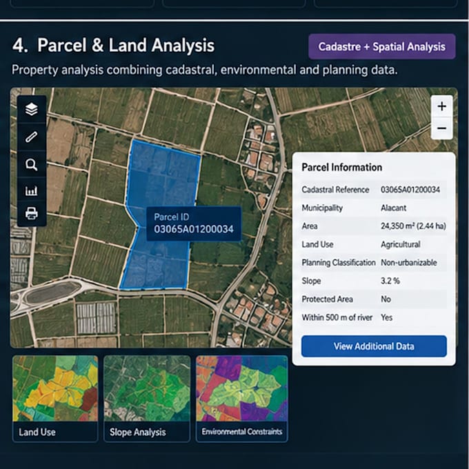
Ich werde Grundstücks- und Flächennutzungsanalyse mit GIS durchführen

A
alexis_ba_
A
alexis_ba_
Alexis B
Einige Informationen wurden automatisch übersetzt.

Über diesen Service

Automatische Übersetzung

Eine parcelbasierte GIS-Analyse erstellt, die Kataster-, Landnutzungs-, Umwelt- und Planungsinformationen kombiniert. Der Workflow ermöglicht es, einzelne Grundstücke anhand von Lage, Fläche, Landnutzung, Planungseinschränkungen und umgebenden geografischen Bedingungen zu bewerten.

Lerne Alexis B kennen

Alexis B

GIS Analyst ArcGIS Python

  • AusSpanien
  • Mitglied seitSept. 2026
  • Sprachen

    Spanisch, Englisch
Hi! I'm Alexis, a GIS Analyst and Programmer specializing in ArcGIS and geospatial data workflows. I work with ArcGIS Pro, Enterprise, Python/ArcPy, SQL, Oracle, LiDAR and FME. I help clients automate GIS workflows, troubleshoot ArcGIS issues, manage geospatial databases, process LiDAR and satellite data, and build web GIS solutions. I focus on practical solutions, reliable results and clear communication. Feel free to contact me before ordering to discuss your project.

Automatische Übersetzung

Mein Portfolio

Verwandte Tags